Tree Detection and Related Applications in Forestry
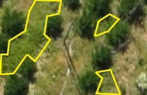
Using aerial images taken by drone, plane or satellite, RSIP Vision can create forestry image processing and analysis software to efficiently determine: Trees detection Automatic
Using aerial images taken by drone, plane or satellite, RSIP Vision can create forestry image processing and analysis software to efficiently determine: Trees detection Automatic
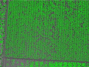
RSIP Vision creates forestry image processing and analysis software by using aerial images taken by drone, plane or satellite. Our algorithms enable to efficiently determine:
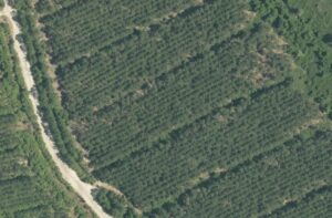
Using aerial images taken by drone, plane or satellite, RSIP Vision develops software for image processing and analysis in forestry to efficiently determine: Forest border
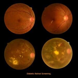
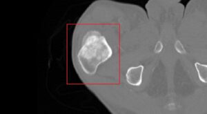
Diabetic Retinopathy (DR) is an eye disease resulting from long-term diabetic condition. About 80% of long-term diabetic patients suffer from some degree of DR, which

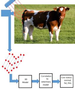
Animal Health Monitoring – Body Condition Scoring For a long time, farmer’s objective was to get the highest milk production from their cows, while feeding them
RSIP Vision creates forestry image processing and analysis software by using aerial images taken by drone, plane or satellite. Our algorithms enable to efficiently determine:
Using aerial images taken by drone, plane or satellite, RSIP Vision develops software for image processing and analysis in forestry to efficiently determine: Forest border
Diabetic Retinopathy (DR) is an eye disease resulting from long-term diabetic condition. About 80% of long-term diabetic patients suffer from some degree of DR, which